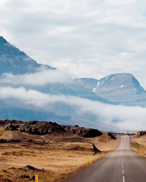

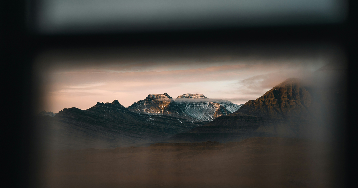
Iceland is the ‘Land of Fire and Ice’, where the forces of nature reign supreme. Perched where the North American and Eurasian tectonic plates meet, this island nation is a showcase of geological wonders. Its dramatic landscape is characterised by stark contrasts, from towering glaciers and steaming geysers to thundering waterfalls and serene hot springs. Iceland's coastline is a rugged masterpiece of fjords, black sand beaches and towering cliffs that plunge into the sea, while the country's interior is a vast expanse of desolate beauty, dotted with volcanic peaks and otherworldly landscapes. Iceland stretches over 40,000 square miles (the same size as Portugal and Hungary combined), making it the second largest island in Europe after the UK.
Iceland’s Landscape
As one of the youngest landmasses on the planet, thanks to its never-ending volcanic activity, Iceland owes its existence to the tectonic boundary on the Mid-Atlantic Ridge. In fact, the country continues to grow around two inches each year, making the geography of Iceland everchanging.
The country's interior is largely uninhabitable due to its rugged terrain, glaciers and deserts. The North is home to the largest lake in Iceland, Lake Þingvallavatn, and the country's highest point is Hvannadalshnúkur, which stands at 2,110 metres above sea level. Iceland’s central highlands are dominated by glaciers - which cover approximately 11% of the country - including the largest glacier in Europe, Vatnajökull. The country is also home to many active and inactive volcanoes, some of which have created vast lava fields, such as Eldhraun in the south and Leirhnjukur (still active) in the north. Iceland has three national parks, each rich with its own unique nature and history: Þingvellir National Park in South Iceland, which is known as an iconic continental rift zone; Snæfellsjökull National Park, named after its crowning glacier and volcano, and famous for being the entrance to the Earth’s core in ancient stories; and Vatnajökull National Park, which is one of the largest national parks in Europe and contains the continent’s largest glacier, Vatnajökull. Iceland is also of course known for its volcanoes. The most active of these include the ice-covered Katla, nestled in the country’s south, and Öræfajökull, an ice-capped beast in the south east. Bárðarbunga, situated in the centre of the country, is also becoming increasingly active.
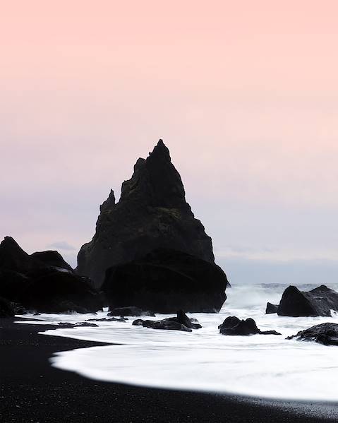
Iceland's 3100 miles of coastline is brimming with steep cliffs, black sand beaches and towering fjords, carved out by glaciers during the last ice age. It also boasts around 30 smaller islands, as well as thousands of rocks and skerries scattered around the mainland. Located off the south coast of Iceland, you’ll find Vestmannaeyjar, a group of 15 islands famous for its puffin colonies. Heimaey is the largest island in the Vestmannaeyjar archipelago, renowned for its scenic hiking trails and the Eldfell volcano, which last erupted in 1973. Flatey is another small island located in Breiðafjörður Bay, known for its colourful houses, historic church and stunning views of the surrounding fjords.
Given the varying geography of Iceland, this snow-capped jewel also experiences an everchanging climate, so have a glance at the best time to visit to ensure you’re making the most of your Icelandic adventure.
Significant Geographical Landmarks
Iceland is home to many geographical landmarks, some of the most notable ones are:
- Vatnajökull Glacier - the largest glacier in Europe, covering approximately 8% of Iceland's landmass.
- Geysir - a geyser that is the namesake for all other geysers, which erupts with hot water and steam every few minutes.
- Gullfoss - a waterfall located in the canyon of the Hvítá river, which drops 100ft into a narrow gorge.
- Þingvellir National Park - a UNESCO World Heritage Site and the location of Iceland's first parliament in 930 AD, also known for its geological and historical significance. It is the only place in the world where you can stand between two continental plates.
- Skaftafell - a national park in south-eastern Iceland, with glaciers, waterfalls and hiking trails.
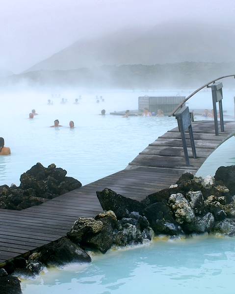
- The Blue Lagoon - a geothermal spa with milky-blue, warm water that is rich in silica and minerals which are said to have healing properties.
- Landmannalaugar - a popular hiking area in the highlands, known for its colourful rhyolite mountains, hot springs and lava fields.
- Dettifoss - the most powerful waterfall in Europe, located in north-eastern Iceland.
- Skogafoss - a hugely popular waterfall on the south coast which often boasts a rainbow or two, glistening in the billowing mist.